































31st July 2026 – (Hong Kong) Super Typhoon Dolphin, whose name was contributed by Hong Kong, has intensified over the western Pacific, with maximum sustained winds near its centre exceeding 200 kilometres per hour on 30th July. The storm is moving west-northwest at about 15 to 20 kilometres per hour, while forecast agencies have significantly adjusted its projected route southwards in recent days.
The latest forecast shift means the threat of a direct hit on Japan’s main islands has largely eased for the time being. Instead, major official weather agencies now generally expect Dolphin to move towards the Ryukyu Islands later next week, pass over waters north of Taiwan, cross the East China Sea and possibly approach areas south of Shanghai. Residents and travellers planning journeys to Okinawa, Taiwan or East China next week are advised to keep a close watch on weather developments and transport announcements.
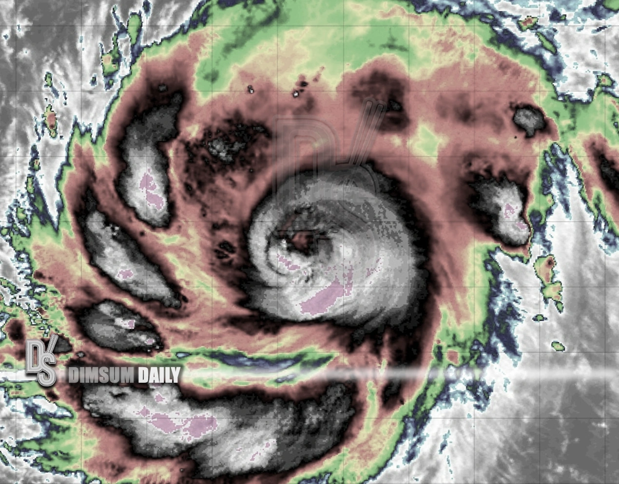
Satellite images on the evening of 30 July showed Dolphin maintaining a compact and powerful structure, with a smaller eye. Visible satellite imagery from Japan’s Himawari-9 satellite on the morning of 29 July also showed a small eye, a rounded and symmetrical circulation, and strong convection near the storm’s centre.
According to the National Meteorological Centre on the mainland, Dolphin was located about 3,140 kilometres southeast of Tokyo at 8pm on 30th July. Its maximum wind force was at Level 17, with wind speeds of around 60 metres per second, equivalent to about 216 kilometres per hour. The centre said the storm was moving west-northwest at 15 to 20 kilometres per hour and its intensity was expected to remain broadly stable in the near term.
The storm’s outer circulation is extensive. The radius of its Level 7 wind circle reached around 400 kilometres to the northeast, 300 kilometres to the southeast, 200 kilometres to the southwest and 300 kilometres to the northwest. Its Level 10 gale-force wind radius extended to around 160 kilometres in the northeast, southeast and northwest quadrants, and 120 kilometres to the southwest. The Level 12 hurricane-force wind radius was about 90 kilometres in the northeast, southeast and northwest quadrants, and about 70 kilometres to the southwest.
Mainland forecasters expect Dolphin to continue moving west-northwest and approach the southern Ryukyu Islands, Taiwan and East China direction later next week, although its strength is expected to weaken gradually after peaking. The National Meteorological Centre forecast that the storm may strengthen further over the next two to three days, with maximum winds exceeding Level 17. Its peak could arrive on Saturday, 1st August, when wind speeds may reach 65 metres per second, or about 234 kilometres per hour.
After reaching that stage, Dolphin is forecast to weaken slightly. By 8pm on Tuesday, 4th August, it is expected to be around 1,100 kilometres south of Tokyo and may be downgraded to a severe typhoon, with maximum winds of around Level 15, equivalent to 48 metres per second or about 173 kilometres per hour.
Taiwan’s Central Weather Administration issued a broadly similar outlook, expecting the storm to move mainly west-northwest in the coming days. It forecast Dolphin’s maximum winds near the centre to rise to around 63 metres per second between Friday afternoon and evening on 31st July, before weakening gradually over the following days. By 8pm on 4th August, the agency expected its maximum winds near the centre to fall to about 51 metres per second.
Forecasts from the Japan Meteorological Agency and the Korea Meteorological Administration also pointed to a similar trend, with Dolphin likely to reach peak intensity within one to two days before continuing broadly westwards towards the central Ryukyu Islands and then weakening. Japan’s forecaster expected maximum sustained winds near the centre to reach about 60 metres per second, or around 213 kilometres per hour, on Friday, 31st July, with maximum gusts possibly reaching 306 kilometres per hour. South Korea’s weather agency expected the storm to peak on Friday evening, with maximum winds near the centre of about 58 metres per second, or around 209 kilometres per hour.
The US Joint Typhoon Warning Centre also gave a comparable projection, with maximum winds near Dolphin’s centre possibly reaching about 240 kilometres per hour in the coming days, close to the peak intensity indicated by mainland forecasts.
Current forecast tracks from major meteorological bodies mainly extend to Tuesday, 4th August, placing Dolphin roughly 1,100 kilometres south of Tokyo by then. Compared with projections made two to three days earlier, when the storm appeared more likely to threaten areas from Kyushu towards Tokyo, the forecast path has shifted more than 1,000 kilometres to the south.
The Hong Kong Observatory has not issued a dedicated forecast track map for Dolphin. Its tropical cyclone track probability forecast updated on 30th July suggested that the system would generally move towards waters south of Kyushu, though the longer-range outlook remained highly uncertain, with possible paths ranging from the Korean Peninsula to Fujian. Hong Kong remains outside the indicated probability zone.
Some extended model guidance suggests Dolphin may continue moving westwards between 5th and 9th August, passing near waters south of Okinawa, entering the East China Sea, skirting areas north of Taiwan and near the Diaoyu Islands, before approaching East China around Zhejiang or areas south of Shanghai. As longer-range typhoon forecasts can change substantially, holidaymakers and airlines are expected to monitor updated official bulletins closely.